Showing posts with label Wales. Show all posts

Monday, 8 March 2021

Offa's Dyke


Offa’s Dyke is an ancient earthwork that roughly follows the border between England and Wales. There were originally about 80 miles of bank and ditch, with natural boundaries covering many of the gaps. The banks were as high as 25 feet and the ditches up to 65 feet wide. Today, some parts of the Dyke are very difficult to discern, but there are still some lengths that are easily seen, such as at Montgomery in Powys. The long distance Offa’s Dyke Path runs close to the original line of the Dyke for much of its length between Chepstow to the south and Prestatyn to the north.

Offa was a powerful king of Mercia during the eighth century, reigning from 757 to 796. By virtue of conquest and arranging strategic marriages for his daughters he eventually controlled all of England south of the River Humber and was the first Anglo-Saxon to earn the title King of the English.

He introduced currency in the form of silver pennies on which his head was adorned with a diadem in the manner of a Roman Emperor.

There are no written records that tell how the Dyke was constructed or even what its true purpose was -whether for defence or merely to mark the boundary between Mercia and the territory of the Welsh princes to the West. One thing that is definitely clear is that Offa was able to muster a considerable workforce to complete the only reason why most people remember his name today.

© John Welford

Wednesday, 3 October 2018

Beddgelert, North Wales


This is Gelert's Grave in the village of Beddgelert in Snowdonia, North Wales - the name is Welsh for "grave of Gelert".
Gelert was a hound that belonged to Llewelyn, Prince of Wales in the 13th century. The story goes that Llewelyn was away from home when a wolf came to his house and attacked his baby son, but Gelert fought the wolf and saw it off, despite being injured.
When Llewelyn came home he could not see the child, but he did see Gelert, covered in blood. He drew the conclusion that Gelert had killed his son and immediately killed the dog. However, as soon as he had done so he heard the baby crying and discovered where Gelert had hidden him in safety from the wolf.
Llewelyn never forgave himself for his rash action, and he made sure that Gelert had a fitting memorial.
(The photo is not mine, but is taken from a copyright-free source)
© John Welford

Saturday, 23 June 2018

Bangor, North Wales


The city of Bangor in North Wales has a very long history. It was also a special place in my youth as the home of my “alma mater” university!

Despite the existence of an earthwork known as “Roman Camp” there is no evidence of Roman occupation here, although they almost certainly passed this way on their way to invade Anglesey in 60 AD. Roman Camp is probably of Norman origin.

A Celtic monastery was founded here in the 6th century, as well as a bishopric that was one of the earliest in Britain. Bishop Deiniol was consecrated in 546 and was later declared a saint. It was after him that the cathedral, founded in the 12th century, was named.

The current cathedral does not contain much material from earlier centuries, being largely the result of extensive 19th century renovations conducted by Sir George Gilbert Scott. Plans to include a high tower and spire were abandoned when there was concern over whether the foundations were strong enough. The result is a somewhat squat building that is not all that distinguished, especially giving the cathedral’s site in a valley between prominent ridges.

Far more noticeable is the main Arts Building of Bangor University, sited on the north-western ridge. This is sometimes mistaken by visitors for the Cathedral, although it more resembles an ocean liner than a place of worship. The University was opened in 1885 (as part of the University of Wales) and is therefore contemporaneous with the restored Cathedral.

I was a student there in the early 1970s and have “fond” memories of having to climb the hill to the college early in the morning then walk up several flights of stairs to the top floor of the College for Philosophy seminars in the Professor’s office! I was a lot fitter then!

Education is now Bangor’s major “industry”, with many buildings across the city being part of the University.

Visitors to the city may be interested to take a walk in the “Bishop’s Garden”, alongside the Cathedral, which aims to include a specimen of every plant mentioned in the Bible that can stand the rigours of the North Wales climate.

Penrhyn Castle, on the eastern approach to Bangor, is owned by the National Trust for Wales and open to the public. It may appear to be of Norman origin but that is an illusion because most of it was built in the 19th century. It houses interesting displays including artworks and a railway museum.

West of the city is the Menai Suspension Bridge to Anglesey, built by Thomas Telford in 1826. Many pleasant walks can be taken across the bridge and alongside the Menai Straits.
 

© John Welford

Saturday, 24 March 2018

The gardens of Powis Castle, Wales


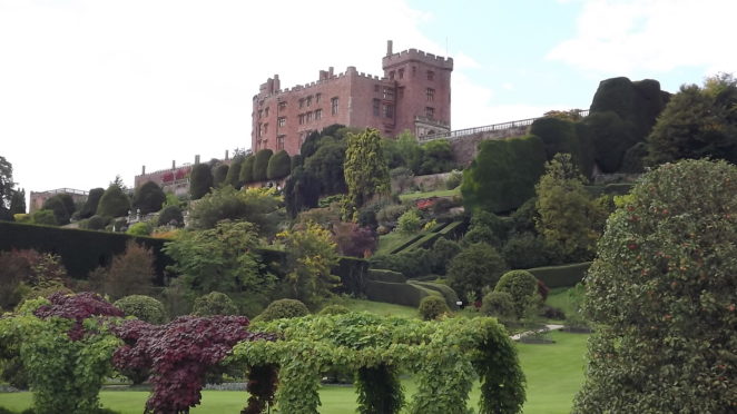
A visit to Powis Castle near Welshpool, east Wales, would not be complete without spending some time in the castle gardens. Apart from the gardens themselves, there are splendid views to be had of the surrounding countryside.

Powis Castle is set on a rocky prominence above the valley in which Welshpool sits, which means that the slope below the castle would be far too steep to plant a garden unless the land was terraced, and that is precisely what has been done. Four broad terraces lead down from the castle to the valley floor, where the gardens continue.

The terracing was started in the early 17th century, but the real work was done in the 1680s by the architect William Winde, who was also a military engineer who knew how to blast the solid rock away to create level surfaces.


The Herbert family, who owned Powis Castle, were supporters of the Catholic King James II, so when the latter was deposed and exiled in 1688, the Herberts went too. They were greatly impressed by what they saw of the gardens of French aristocrats and royalty, so, on their return in 1703, they set about creating a garden that incorporated features that they had seen in France and on their travels around continental Europe.

The gardens seen today owe much to the efforts of a more recent family member, namely Violet Lane-Fox (1865-1929), the wife of the 4th Earl of Powis who left the castle and its grounds to the nation on his death in 1952. The countess sought to restore the gardens to their former splendour after many years of neglect, just as her husband did for the castle.

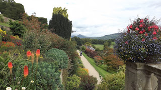
The four terraces contain a profusion of flowering and foliage plants backed by stone and brick walls and framed by low box hedges. Classical statues of nymphs and swains add a continental touch.


The massive yew hedges on the upper terraces and particularly at the northern end are notable features of the Powis Castle gardens. These hedges were originally trimmed into intricate shapes but are now “cloud pruned” into bulky shapes that are no less impressive. A photo on display in the garden shows how the hedges were pruned in former times, with gardeners climbing up 40-foot ladders and standing on top on the hedges armed with shears, but in these more health-and-safety-conscious times the job is done from a mechanical cherry-picker!


Below the terraces is a mixture of garden types, including a formal garden in the 18th century style, a croquet lawn, and the Grand Lawn that was originally a water garden. One area has been allowed to run wild (although it is full of daffodils in the spring) in order to encourage wildlife. There is a large area of woodland with paths running through it, and a small lake that is also designed as a wildlife haven.


It would be very easy to spend a long time in the garden, but the visitor needs to remember that the gate is locked at 5.30pm (earlier out of the summer months) and it takes longer to walk up four terraces to the exit than down!
© John Welford

Monday, 19 December 2016

A first-time visitor's guide to Wales


A visitor to the United Kingdom should be encouraged to include Wales on their itinerary, because it is a very special part of the country and different in many ways from England or Scotland.

Visiting Wales for the first time

Anyone who is not a native or a resident of Wales, but has spent an appreciable amount of time there, whether as a student or a holidaymaker or both (like me), will testify that it is impossible to “do” Wales in a single visit, whether that lasts a week, a fortnight or a month.

Wales is relatively small, being about 8,000 square miles in total in a roughly rectangular shape some 160 miles from north to south and 60 miles from east to west. It is therefore not quite as big as New Jersey. However, it is usually best to think of Wales as having three distinct zones, namely North, South and Mid.

This is because of the mountainous territory of most of Wales that makes travel between north and south quite difficult, as most of the road and rail links run from east to west. The visitor is therefore best advised to aim for one of the three regions and to leave the others for another time. Whichever they choose, there will be plenty to see and do.

The first timer should also decide their priorities in terms of what they want to get from their visit. For example, are they most interested in Welsh culture, or its natural scenery, or its castles, or its beaches? Do they want to surf, or to climb mountains, to pony trek, to watch wildlife or travel on its “great little trains”? There is no reason to plump for just one option, but if you have a particular aim in mind, it might not be so easy to plan your visit in a way that incorporates certain others.

For example, Wales is noted for several heritage rail lines that were originally built to transport slate and other goods from the quarries to the coast. These are to be found in Mid and North Wales, and a certain degree of planning would be needed to fit them all into a short break. If the visitor is also interested in the cultural delights of Cardiff, with its first-rate venues for music, opera and theatre, then combining the two interests would be difficult.

It is impossible, in a short article, to describe all that Wales has to offer, so a short breakdown of the three main regions will have to suffice.

South Wales

This is where the majority of Wales’s population lives, particularly in the only two Welsh cities of any size, namely Cardiff and Swansea. The wealth of Wales in the 19th and 20th centuries came from coal-mining and steel, and it was in south-east Wales that these industries were based, although there is little sign of them now.

For the tourist, Cardiff has far more to offer than Swansea, especially since the development of Cardiff Bay that has taken place in recent years. Cardiff, the chief city of Wales, was always an attractive city, with its castle and the civic centre and university buildings around Cathays Park, but the waterside developments, including the new Welsh Assembly building, are generally agreed as being particularly impressive. The tourist could make Cardiff their sole destination with no trouble at all.

However, South Wales has much more to offer, including the magnificent coastal scenery of the Gower peninsular and Pembrokeshire, and the brooding mountainous territory of the Brecon Beacons and Black Mountain. Walkers are well served, whether the choice is hills or coast paths, as are families who seek safe beaches and rock pools.

Mid Wales

The heart of Wales is a land of lakes, forests, deep valleys and windswept moorlands. This is wild country with only a few villages and not many roads. It is therefore a region that will suit people who want to get away from it all, but they will also have to be largely self-reliant.

The chief town of mid Wales is Aberystwyth on the coast, home to the oldest university in Wales and the National Library. It is also well used to catering for tourists, with many small hotels and guest houses. The railway line from Shrewsbury (in England) ends here, as does the steam-powered narrow-gauge Vale of Rheidol line.

Aberystwyth is at the mid-point of Cardigan Bay, on which can be found many unspoilt and lonely beaches. Whether one goes inland or stays on the coast, this is excellent territory for wildlife enthusiasts, particularly birdwatchers.

North Wales

The region is dominated by Snowdonia, the mountainous area centred on Snowdon, the highest mountain in Wales. A mountain railway can take you to the summit, or there are a number of well-marked paths that are very popular in summer. The area is something of a tourist trap, so visitors would be well advised to explore other parts of the region if they do not wish to be where everyone else is.

Also popular are the large and well-preserved medieval castles of Harlech, Caernarvon and Conwy. These are reminders of Wales’s history and its eventual domination by England in the 14th century. Children love exploring castles, and North Wales has some fine examples.

The coast of North Wales, eastward from Llandudno, is popular with tourists from the cities of north-west England, so visitors might prefer to head further west, to the Lleyn peninsular and Ynys Mon (Anglesey). It is not difficult to get away from the crowds when one wants to.

Culture in Wales

The first-time visitor should make every effort to absorb some of the culture of Wales, which has a tradition of choral singing that goes back for centuries. If you can attend a concert given by a Welsh male-voice choir it will be an unforgettable experience. Even better is an “eisteddfod” (Welsh for “sitting”) which is a festival of music, dance and literature. The 8-day National Eisteddfod is an annual festival held in early August, but local eisteddfodau are also held at other times and places.

Food is part of a nation’s culture, and Wales has some culinary customs of its own, such as the use of seaweed to make “laver bread”. Welsh lamb is highly prized, with sheep rearing being the dominant agriculture in many parts of the country. Leeks are typical vegetables and are one of Wales’s national symbols. On the sweeter side, “bara brith” is a bread made with raisins, currants and fruit peel.

The national sport of Wales is rugby football, with most of the big clubs being in South Wales. National pride is very much to the fore when Wales play at Cardiff’s Millennium Stadium, especially if the opponents are England! Tickets are much more easily obtained for club matches, but the passion on display is always high.

The Welsh language

The first-time visitor, especially one from beyond the United Kingdom, may be surprised to find that a language other than English is spoken here. Welsh is an ancient Celtic language that was once spoken across most of England as well, before England was created by invading Angles and Saxons in the 5th and 6th centuries. The invasion never reached Wales, so the language was preserved.

The visitor will soon see that all road signs and many other public notices are in both Welsh and English, with Welsh usually given priority. Welsh is spoken as the first language by about 20% of the population, although the proportion is much higher in north and west Wales.

You will hear Welsh spoken in shops and whenever local people get together, but this should not worry the visitor, because every Welsh speaker is bi-lingual, having learned both languages from an early age. That said, Welsh people are justly proud of their language and appreciate it when visitors take the trouble to learn a few phrases, such as “bore da” (“good morning”).

The first-time visitor to Wales is unlikely to be an “only time” visitor, because a first visit can only be a taster of what Wales has to offer. There is so much variety, especially in outdoor activities, and Wales keeps many of its secrets well hidden, only to be prised out by the determined explorer.

© John Welford


Friday, 14 October 2016

Bangor Pier, North Wales


This is an introduction to a restored relic of a bygone age, namely the pier at Bangor, North Wales. I stayed in a house overlooking the pier and relived memories of my time as a student at the nearby University.


The Victorians' love of piers

The Victorians had many admirable qualities, among which were a desire to stay healthy by taking gentle exercise, and excellent engineering skills. When the two came together the result was the seaside pleasure pier. Very few seaside resorts around the British coast did not have at least one pier by the end of the Victorian era, and the top resorts had several magnificent structures striding out to sea, such as Brighton with three!


Bangor Pier

Bangor, in north-west Wales, had to wait a long time for its pier, as it was not opened until 1896 when Queen Victoria was nearing the end of her life and reign.

Like most constructions of its kind, it had two main functions: as a place to promenade and take the sea air, and as a landing stage for pleasure steamers.

However, at low tide you can see that this pier had a third reason for its existence, as it is built on a foundation of hidden rocks that stretch for about two-thirds of its length. With the pier in place, no vessels would be tempted to take a short cut and risk grounding on the rocks.

From the picture above, you might query whether this is a sea pier at all, or merely an incomplete bridge. Bangor is at the eastern end of the Menai Straits, and the land you can see is the island of Anglesey (Ynys Mon in Welsh). The pier only goes half way across, ending at the deep water channel that has been scoured out by the strong tides that sweep through the Straits.


Construction and design

The pier was constructed mainly from steel, supported on spindly-looking cast iron columns and with a broad wooden decking. A landing stage was built at the sea end, together with a pavilion that today serves as a small cafe. At intervals along the 1550 foot length are small shelters, in pairs, with conical roofs. Today these are used as kiosk shops, mostly run by local charities. There are also ornamental lamps and seating along the sides of the pier. The two towers at the pier entrance have onion-domed roofs that betray the Victorian love of everything oriental.

The pier made Bangor fully accessible to coastal shipping, mainly for pleasure but also serving commercial purposes. Steamers ran from here along the North Wales coast, and also across the Irish Sea to the Isle of Man and Blackpool.


Decline and restoration

In 1914, a steamer failed to moor properly and collided with the pier, causing considerable damage and making it necessary to bridge the gap with a walkway that, because of the First World War, stayed in place for far longer than was intended. It was not until 1921 that the pier was finally repaired.

I was a student at Bangor University in the early 1970s but was never able to visit the pier at the time because it was in very poor repair and closed to the public. There was even talk of demolishing it altogether. However, a restoration project was started when it was declared to be one of the three finest surviving piers in the country (i.e. the UK, not just Wales). Raising the finances was a huge task, and it was not until 1982 that the work started. This took six years to complete, but when it was reopened in 1988 it was in a condition that its Victorian builders would have been proud of.


An uncertain future

Unfortunately, the story of restoration does not end there, because the pier is still in need of work to maintain it and keep it in a safe condition. There has been some concern that not enough money has been set aside by the local council to keep the pier in good condition. 

At a time when local authorities across the country are desperately seeking ways to save money, maintaining a Victorian relic such as a pier might not come very high on the list of priorities. It would, however, be a shame if Bangor pier once again had to be closed due to safety concerns.


Visiting the pier


As thing stand, the pier is open throughout the year. There is a small entrance fee, but for much of the year you are asked to place your money in an "honesty box" at the gate. The views from the pier are magnificent, along the coast towards the Great Orme Head, down the Menai Straits, or inland.

The pier is an excellent vantage point for fishing, and for bird-watching. At low tide the nearby mudflats are exposed and thousands of wading birds come to feed, including oystercatchers, redshanks and little egrets.

If you are passing through this area, why not stop off for an hour or so to take a break and wander along the pier? You won't regret it! There's even a pub that serves excellent food very close to the pier entrance! 


© John Welford

Thursday, 29 September 2016

Ramsey Island, Pembrokeshire: a visitor's guide


Ramsey Island lies one mile off the Pembrokeshire coast (southwest Wales) and is a nature lover’s paradise due to its careful preservation and management by the RSPB (Royal Society for the Protection of Birds). It is uninhabited by humans apart from the RSPB wardens and a small volunteer staff, and access is carefully controlled to ensure minimal disturbance to the island’s extensive wildlife.

A visit to Ramsey Island

Visitors need to book a trip on the boat that leaves from the lifeboat slipway at St Justinians, which is two miles from St David’s. Boats leave at 10 a.m. and 12 noon, with the return trip at 4 p.m. (The wardens count their passengers carefully to ensure that no-one gets left behind!). The service operates from April to October and does not run if the sea is too rough for the crossing to be safe.

There are a lot of steps to be climbed both at St Justinians and on reaching the island, and the island paths are also fairly strenuous, so this is a trip for people who are reasonably able-bodied. There is not much shelter on the island once you leave the buildings close to the landing stage, so you need to be equipped with proper wet-weather gear (as well as appropriate footwear) should rain threaten. Cameras and binoculars should also be regarded as essential items!

On landing at the island you will be escorted to a small information centre where there are displays showing all the wildlife that you might expect to see, depending of course on the time of year that you visit. A friendly and enthusiastic volunteer will give a short talk on how to make the most of your visit, plus a few dos and don’ts. One very important don’t is a warning against leaving the designated path, especially near cliff edges given that Ramsey Island’s cliffs are the second highest in Wales (up to 120 metres). Another don’t is a complete ban on visiting the beaches around the island, because this is where the seals feel safe and they must not be disturbed.

The trail around the island is 3.5 miles long (5.6 km). You should have plenty of time to complete the trail, which takes you to all the different habitats, and you will also be able to stop many times as you see interesting things and take in the views. However, if time is short there is a shortcut across the middle of the island that will take you back to the boat jetty, although this path is only open from July onwards due to lapwings nesting in the area close by.

Because visitor numbers are limited you will soon find that you are well away from other people and will probably only see them from time to time in the distance or coming the other way if they chose to take the trail in the opposite direction to you. This is therefore an excellent place in which to feel that you and your family are on your own with just the wind, the sea and the wildlife for company.
Facilities on the island are adequate but not luxurious. You will be invited to make use of the toilets and “leave a deposit”, given that human waste is recycled to make fertilizer. While entering and leaving the toilet block in the old farmyard you may well be buzzed by swallows as they fly in and out.

Light refreshments are available at the warden’s house and there is a small shop selling RSPB merchandise. However, you will certainly not be overwhelmed by commercial activity, which is kept to a minimum. What will impress you is the friendly and approachable attitude of the RSPB volunteers who will do everything they can to inform you about the island and its inhabitants and will be happy to chat with you as you wait for the boat to take you back to the mainland.

What you should see

As mentioned above, the wildlife on view will depend in part on whether you visit in spring or summer. Springtime is best for seeing birds nesting on the cliffs, including peregrines, choughs, ravens, razorbills and guillemots. Inland you should see plenty of wheatears and might spot a few little owls. This is also the time to see the cliff-top flowers at their best, such as bright pink thrift.

Later in the year you should be able to see grey seal pups on the beaches and porpoises feeding in Ramsey Sound between the island and the mainland. Kittiwakes and fulmars should be around until August. The heathland plants are at their best in summer, with pink, purple and yellow being the dominant colours. Towards the end of summer you might see some unusual birds passing this way on their migrations.

Apart from all that, you will have a great walk round a beautiful island that has been largely untouched by human hand. This is not 100% true, because, as is evident from the buildings that you pass through as you start your walk, the island has been commercially farmed in the past. In order to keep the vegetation at the right level to suit the bird and animal population, a small herd of rare-breed cattle are allowed to graze and fertilize the inland area. The heathland is maintained by periodical controlled burning, which may alarm the visitor but is perfectly in order as a means of preserving the habitat of the bird population.

One bird that visitors will not see is the puffin, although the sight of what appear to be puffin burrows on the cliff tops may give this impression. Ramsey Island did have a rat problem at one time, which put paid to puffin breeding, but, although the rats have long since been dealt with, the puffins have not returned and prefer to colonize other islands in the area, such as Skomer which is just a few miles to the south. The burrows are, however, used by manx shearwaters which breed on Ramsey in spring and early Summer.

Time to spare?

The company that operates the ferries to Ramsey Island runs several other boat trips from the St Justinians lifeboat station. These include a “round the island” trip which you can take after you return from the island itself. This trip is an excellent way to see grey seals on the small beaches around the island, as these are often not visible from the cliff tops above (Ramsey has the largest colony of grey seals in southern Britain). If your trip coincides with a change of tide, you can witness at close hand the race that forms as sea water rushes into Ramsey Sound at high speed between the rocks, roaring as it does so. The boatman is quite likely to take the boat straight into the race, which could result in his passengers getting more than a little wet!

All in all, a visit to Ramsey Island is a day well spent, especially for the visitor who is a keen birdwatcher and nature lover.


© John Welford

Friday, 19 February 2016

Aberystwyth, Wales


Aberystwyth is a Welsh town that I used to know quite well, as I was a student there on two occasions, a decade apart.

Situated half way along Cardigan Bay, Aberystwyth is almost on the line that divides North Wales from South Wales, in cultural and linguistic terms. A Welsh-speaker who moves across the line is soon spotted as a “foreigner” because of the markedly different accents and word use north and south. Aberystwyth is thus something of a “melting pot” in this regard.

There is something about the name of this town (population about 16,000) that might raise an eyebrow or two, given that the river that flows to the south of the town and reaches the sea via the small harbour is the Rheidol and not the Ystwyth, and the town name translates as “mouth of the Ystwyth”. Surely it should be “Aberrheidol”?

The reason for the name is that the original settlement was located a mile and a half south of the current town, being a fortress built in the early 12th century by a Welsh-Norman lord known as Strongbow. This fortress was on a hill near where the River Ystwyth reached the sea, thus the name Aberystwyth was entirely appropriate. However, when the English King Edward I rebuilt Strongbow’s castle in 1277 he did so on a promontory that overlooked the Rheidol, but the name stuck.

The story does not end there, because natural processes built a sandbank across the mouth of the Ystwyth and cut off its route to the sea. It was thus forced to flow north, and it now joins the Rheidol at the southern tip of Aberystwyth Harbour. So the name Aberystwyth is now just about correct!

The castle built by Edward I is now a ruin, although there are fairly substantial remains of several towers and the curtain wall. Much of the damage was done during the Civil War, when it was slighted by Cromwell’s troops, but it had been in poor repair long before then.

Castle Hill is a good spot from which to view the coastline as it sweeps dramatically north and south. Also to be seen from here is a strange-looking building that is key to Aberystwyth’s prosperity in more recent times. The building in question has a wedge-shaped end with a rounded “nose” and circular turrets on its roof. As you walk along on the seaward side you can see that it is a complete mish-mash of styles, some of it in two storeys, some of it in four, with round bits and square bits and possibly triangular bits as well. 

This started life as a hotel that went bankrupt in the 19th century and was acquired by the new University College of Wales in 1872 as its first building. It is still part of Aberystwyth University, although the bulk of the University’s buildings are a mile or so inland at a purpose-built campus.  “Old College” has to be one of the most unusual university buildings to be found anywhere, and it is just as bizarre on the inside as the outside.

If you continue past Old College and Aberystwyth’s apology for a pier you will see the impressive sweep of Marine Terrace, comprising a continuous row of three- and four-storey buildings that look out over the beach (sand and shingle) to Cardigan Bay. Many of these buildings are hotels and guest houses, although there are a number that have been converted into student accommodation.

At the end of the terrace is a cliff railway that operates during the summer months. From the top there are excellent views out to sea and along the coast.

As mentioned above, the main campus of Aberystwyth University is a little way inland, up one of the hills that surround the town. Just below the campus is one of the most important buildings in Wales, namely the National Library of Wales. It contains more than two million books and three million other documents, including priceless items relating to the history and culture of Wales. As well as the 12th century Black Book of Carmarthen, which is the oldest surviving manuscript in Welsh, it has a copy of my 1989 Master’s dissertation – two treasures indeed!

A little further inland is what used to be the College of Librarianship Wales, formerly an independent college affiliated to the University of Wales but now part of Aberystwyth University. This was where I studied for my Diploma in Librarianship in 1975-6 and returned to take a Master’s degree in 1988-9. I therefore have many fond memories both of the college and the town of which it is a part.

Another attraction not to be missed is the Vale of Rheidol Railway. This is a narrow-gauge steam-hauled railway that takes passengers from Aberystwyth to Devil’s Bridge, 12 miles inland. The scenery that these “great little trains of Wales” pass through is absolutely stunning. The locomotives used today date from the 1920s, although the line has been operating since 1902.

Aberystwyth has a main line rail link that brings passengers from Shrewsbury and Wolverhampton. This has helped to make the town a holiday destination as well as a centre of learning.


© John Welford