Showing posts with label cornwall. Show all posts

Tuesday, 22 January 2019

The Lizard Peninsula, Cornwall


The tip of Cornwall’s Lizard Peninsula is the most southerly point of England. The cliffs rise to 70 metres (200 feet), broken by small rocky coves, some of which house harbours and tiny fishing villages.

The rocks that form the Lizard are of great interest to geologists. Serpentine is predominantly green in colour and can be worked into attractive ornaments, which are less popular now than they were in Victorian times. The parish church of St Wynwallow at Landewednack was built from blocks of granite and serpentine, and the pulpit and font were both carved from serpentine. Landewednack is the most southerly parish in England.

Soapstone is another interesting rock found here.

Popular coves include Mullion Cove, which has a picturesque harbour and an island bird reserve, and Kynance Cove which has caves to explore and a blowhole called the Devil’s Bellows through which the sea spouts when the tide comes in.

On the eastern side of the Lizard are the villages of Cadgwith and Coverack. The latter name is Cornish for “hideaway”, which refers to the previous use of the area as a smuggler’s haven.

Offshore are the dangerous rocks known as the Manacles, which have been responsible for many shipwrecks in the past. The tall spire of the church of St Keverne was a vital landmark for ships in the Channel, and the churchyard is the burial place of many sailors who failed to set their course correctly despite the spire’s guidance.

Myths abound in a place like this, and these include stories of mermaids. One tells of an old man who rescued a mermaid and returned her to the sea, for which kindness she granted him three wishes. When his time came to die she came for him and took him out to sea with her. 

Whether or not you believe tales like this, The Lizard is still a place of particularly grandeur and wild beauty.

© John Welford

Monday, 30 July 2018

Gribbin Head Daymarker


This tall square tower stands on Gribbin Head, southwest of Fowey on the south Cornwall coast. To all intents and purposes it looks like a lighthouse, complete with red and white stripes, apart from one fundamental difference – no light!

Instead it is a “daymarker” as opposed to a “nightmarker”. The tower stands 84 feet high (25 metres), and is easily visible to sailors out at sea, but only during daylight hours. It has been in place on the headland since 1832.

So why was it built? 

The problem was that Gribbin Head (known to locals as “The Gribbin” looks very similar from out at sea to St Anthony Head, which is a few miles to the west, on the eastern side of Falmouth Bay. Sailors heading for Falmouth Harbour would naturally steer to the west of St Anthony Head, but if they made the mistake of confusing the two headlands, they would instead sail blindly into the shallow water of St Austell Bay to the west of Gribbin Head and be wrecked.

This mistake was only possible in daylight, because no ships would be attempting to reach port at night, so a daymarker was what was needed to warn them of the danger.
© John Welford

Tuesday, 27 March 2018

Tintagel Castle, Cornwall


This ancient castle on the north coast of Cornwall is associated with the legends of King Arthur and of Tristan and Isolde. The truth may never be known, although a 1998 find of a 1,500 year old piece of slate bearing the name “Artognou” excited a fresh round of speculation.
Although Tintagel was occupied during Roman times and was a trading post for Celts in the 5th and 6th centuries, the castle we see today was built in the 13th century by Richard, Earl of Cornwall (1209-72). Richard was a brother of Henry III, who gave Cornwall to Richard as a birthday present. What he did when Christmas came along is not recorded!
The castle is sited on a rocky island that is connected to the mainland by a footbridge. More than 100 steep steps then lead up to the castle entrance, hence it is inaccessible for disabled visitors. The castle itself is a ruin, but many features of the ground plan can be made out from the remaining walls, and the views in all directions are stunning.
© John Welford

Tuesday, 20 March 2018

King Henry VIII's Cornish castles


Following his divorce from Catherine of Aragon in 1533, and his break from Catholic Europe, King Henry VIII became increasingly concerned that he had made England vulnerable to invasion from either France or Spain. It was in order to guard against any threat from Spain that he built three castles in Cornwall that were designed to protect the ports of Falmouth and Fowey on the county’s south coast. These castles – armed with artillery pieces – would be the first land-based line of defence should any Spanish ships sail up the English Channel.


St Mawes Castle

Sited on the eastern side of the mouth of the River Fal, the castle was designed purely as a base for artillery fire. There is a four-storey central round tower and three circular bastions arranged in a clover-leaf pattern. The flat-roofed bastions were simply platforms for artillery pieces.


The castle is in an excellent state of repair, this being mainly because it continued in use long after the threat of invasion during King Henry’s reign had passed. At various times it acted as a garrison, although its small size meant that not many soldiers could be accommodated. It was only at the close of World War II in 1945 that St Mawes Castle finally lost its function as a military base.
However, despite all this apparent importance to the security of the realm, no gun was ever fired in anger from St Mawes Castle!

Pendennis Castle

Originally the western companion to St Mawes, and similar in design, Pendennis underwent much more development in subsequent years. Like St Mawes, Pendennis continued in use as a military base right up to World War II, but it was given greater importance because of its proximity to the port of Falmouth. New fortifications were added by Elizabeth I following the Spanish Armada, and yet more in the years preceding the English Civil War, during which the castle – held by supporters of King Charles I – was taken by Parliamentary soldiers following a five-month siege.


Visitors can see an interactive exhibition of the castle’s history, mounted in the Royal Artillery Barracks that date from 1901, and a special collection of World War II cartoons by the artist George Butterworth. A land train connects the castle with Falmouth town centre during the summer months.


St Catherine's Castle

This is another of Henry VIII’s coastal defensive castles, built to defend Fowey, some 20 miles north-east of St Mawes/Pendennis. This castle is nothing like as well preserved, consisting of a round two-storey tower, now open to the elements, with gun ports at the ground level. A small gun platform was added in 1855. The castle can be reached via a woodland path or from the beach of nearby Readymoney Cove. As this site is unstaffed, admission is free.


It should be noted that times of admission to these three castles vary considerably from site to site and they also change depending on the day of the week and the month of the year. Intending visitors should check the English Heritage website to avoid a wasted journey.

© John Welford


Thursday, 15 March 2018

Bedruthan Steps, Cornwall


In order to get down to the sandy beach at Bedruthan, between Newquay and Padstow on the north Cornish coast, you have to descend a long zigzag stairway, but these are not the steps in question!

The Bedruthan Steps are a group of sea stacks that stand on the beach at low tide. At one time the coastline was beyond where the stacks are now, but erosion of the slate cliffs created firstly caves and then arches which collapsed, leaving the harder bits of rock behind as isolated stacks.

As one might expect, there is a local myth that explains the stacks in far more interesting terms. This is that Bedruthan was a local giant who used the stacks as stepping stones (hence “steps”), although nobody is all that sure where he was trying to get to!

Visitors can make use of the clifftop National Trust shop and café that used to be the office of the Carnewas iron mine. This visit can be before or after the climb down the wooden steps to the stone ones, at the base of which can be found rock pools in which all sorts of small marine life can be found.

The problem with climbing down a cliff is that you have to climb back up again at some point. So maybe the Cornish cream tea at the café can be your reward!

© John Welford

Monday, 19 December 2016

Fowey, Cornwall


The southern coast of Cornwall has several river valleys that form wide estuaries as they meet the sea and offer a softer landscape than that of the rocky headlands of the far west and north Cornish coast. One of these estuaries is at Fowey, a few miles east of St Austell.

A relic of the Ice Age

The river valleys of Cornwall turned into tidal estuaries when sea levels rose after the end of the last Ice Age; the technical term for such a feature is “ria”. These have created deep water anchorages at the river mouths and stretches of water that are navigable much further inland than would otherwise have been the case.

The enlarged valley of the Rover Fowey (pronounced “Foy”) has been used commercially since Roman times, when tin mining was carried out further inland. The trade in later centuries was in china clay, large quantities of which are still extracted from the quarries near St Austell.

The port of Fowey was also important in past centuries as a military base. In 1346 the town supplied 700 men and 47 vessels for the siege of Calais, as against only 25 that sailed from London. In later years the seamen of Fowey turned their hand to piracy.

Fowey town

The houses and other buildings of Fowey crowd closely together around a jumble of narrow streets (including a “Trafalgar Square”). The waterfront, with its tall buildings, is best seen from the other side of the harbour and makes a very attractive sight at night when lit up.

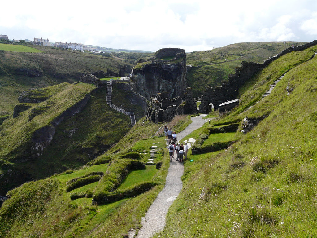
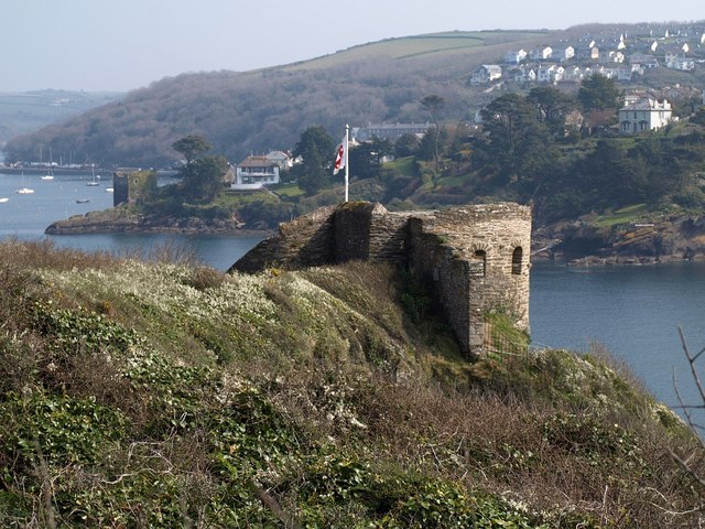
Just south of the town is St Catherine’s Castle on a rocky promontory above the sea. This was built on the orders of King Henry VIII as one the chain of castles intended to defend ports all along the English south coast 
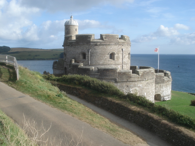
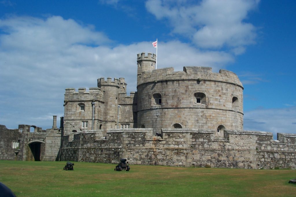
at a time of threat from France. It was a small artillery fort that was never as well developed as other Cornish defences such as St Mawes and Pendennis castles (although it was extended during the 19th century Crimean War), but a visit is worthwhile If only for the views to be had from its walls.
  
Getting away from the crowds

The small towns and villages that dot the Cornish coast are notable for being tourist traps in summer, and the town of Fowey, with its narrow streets, is not immune from the effect of its attractiveness. It is, however, less commercialised than some other places such as Polperro, which is eight miles to the east. It is therefore advisable to explore Fowey on foot, having left your car at the car park on the edge of town.

It is, however, perfectly possible to get away from the crowds if one is prepared to forget the car and walk along the river and cliff paths on either side of the harbour.

East of the river

Access from Fowey is made possible by the ferries that cross the short distance from Fowey to Polruan (foot passengers and bicycles only) and Boddinick (cars and foot passengers).

A popular walk is the four-mile “Hall Walk” that uses both ferries and skirts the Pont Pill tributary estuary of the Fowey River. There are excellent views of the harbour and only two steep climbs.

Other walks can take in part of the Southwest Coast Path along the cliff tops.

West of the river

You are bound to escape the crowds if you take a walk on the peninsula to the west of Fowey Harbour, because much of this area is not accessible by road.

Not far along the coast is the secluded small bay of Polridmouth (pronounced Pridmouth) which is half a mile from the nearest road. A dam across the small river that empties into the bay has created a freshwater ornamental lake.

Another walk can take you to Gribbin Head, with its red and white “day mark” (a sort of unlit lighthouse) and the small harbour at Polkerris (which has a pub!). This walk affords magnificent views out to sea and along the Cornish coast to the west.

Wildlife

This is an area that is rich in plant, animal and bird life. Sea spurge and edible rock samphire grow along the shoreline, and the cliff tops abound with cornflowers, field pansies, speedwell and tormentil. The Pont Pill estuary is wooded, with oak, ash, chestnut, beech and sycamore being the prominent tree species.

Among the birds to be seen are kestrels, skylarks, meadow pipits, wheatears and stonechats.

A famous former resident

Fowey was the home for many years of the writer Daphne du Maurier (1907-89). One of her homes, Menabilly, was the model for “Manderley” in her best-known novel “Rebecca”. It has been suggested that Pont Pill was the original “Frenchman’s Creek”, although it is generally believed that she had in mind the Helford River much further west.

Fowey hosts an annual Festival of Arts and Literature in her honour.

All-in-all, this is a very pleasant corner of Cornwall to visit, especially for people who like their towns picturesque and their countryside unspoilt and uncrowded.


© John Welford

Thursday, 28 January 2016

The Penwith Peninsula, Cornwall


The Penwith peninsula is the “toe” of Cornwall, comprising the most westerly portion of mainland Britain and including the rocky cliffs of Land’s End. Penwith is of interest to the walker, birdwatcher and enthusiast for history, both ancient and industrial.

The Penwith Peninsula

Most tourists make a beeline for the “first and last house” and the signpost that points the way to John O’Groats in one direction (874 miles) and New York in the other (3147 miles), but it would be a mistake to ignore the rugged scenery of the granite outcrop that leads to this point.

The Cornwall coast path that circumnavigates the Penwith peninsula runs for 36 miles from St Ives to Penzance, although it can be tackled in shorter sections as it is rarely far from a road along which  bus services run (albeit infrequently!) to take the walker back to base.

The path westwards from St Ives, for example, winds between rocky headlands and remote coves which were once used by smugglers. Walkers sometimes need to descend steeply to cross fast-flowing streams and then clamber up the other side, so progress is unlikely to be rapid. That does not matter, because there is much to see here; not only views of the sea breaking against the rocks below, but, depending on the time of year, of birds such as herring gulls, fulmars and auks, and seals in the less accessible coves and on offshore rocks. The natural flora of the area includes pink thrift, purple heather and yellow gorse which is sometimes blanketed by red tendrils of dodder, a parasitic plant.

Cornish tin

West Cornwall was for many centuries a centre for tin mining, although this has now ceased (pending a possible revival). There are many monuments to the industry to be seen, mostly along the coast such as at Botallack near St Just. The mine workings extended half a mile out to sea, but the towers that stood above the shafts and contained the winding gear and engines were built close to the cliff edge. The tin was smelted locally and produced arsenic as a by-product. Some of the furnaces used in this process can also be seen.

One of the last working tin mines was at Geevor, near Pendeen, and the pit has been preserved as a museum that includes underground workings that can be visited. The idea of the museum is to give as faithful an impression as possible of how the mine operated, as well as to provide an enjoyable experience for a family visit.

Abundant evidence of ancient settlements

Inland from the coast, the granite hills of Penwith have changed little for thousands of years. The visitor can see a microcosm of Celtic Britain in the form of burial mounds, monuments, field boundaries and even an entire village. Not only was this region too remote and inhospitable for large-scale development, but the lack of woodland meant that the local people, who started mining back in Bronze Age times, were forced to build in stone, much of which has been preserved down to the present day. Penwith boasts the largest concentration of prehistoric antiquities in the whole of Great Britain.

Burial mounds were formed by setting three or four stones on end and laying a slab across the top. The walls and roof would have been made from turf that has long since disappeared, leaving the stone skeleton behind as a “cromlech” or “quoit”. Lanyon Quoit is one such monument, alongside the road from Morvah to Madron. It was re-erected in the early 19th century after falling in a storm and now stands only one metre high, although it was originally possible for a horse and rider to pass beneath the 13 ton horizontal slab.

Not far away is Men-an-tol, which features a stone set on edge with a circular hole in it, with other holes nearby. The original purpose of this site is unknown, but local folklore maintains that it had healing powers and that children were passed through the hole to cure them of rickets.

The most remarkable ancient site in Penwith has to be Chysauster Ancient Village (see photo), not far from the road between Penzance and St Ives. This was an Iron Age settlement dating from around 100 BC. Each house in the village, of which nine can be traced on either side of a central street, had a central courtyard around which were several rooms that would have had thatched roofs. Also on the site are the remains of a “fogou”, a stone-walled underground passage that may have been used for security or storage purposes.

Mousehole and Penlee

The village of Mousehole (pronounced “Mowsul”) is also not to be missed. This is a small fishing village, grouped around its harbour, that has retained its character down the centuries and will continue to do so thanks to its conservation status. Unfortunately, its very attractiveness causes it to become crowded with tourists in the high season, and so it is best visited at other times of the year.

Not far from Mousehole is the former Penlee lifeboat station that is a stark reminder of how the forces of nature can make life in this area difficult and dangerous. On the night of 19th December 1981, eight volunteer lifeboatmen lost their lives when called to rescue the crew of a cargo ship that had been thrown on to the rocks by an Atlantic storm.

Worth a visit?

This wild and windswept area of land at the far end of England is certainly worth a second look. It would a waste to go all that way just to say you have “done” Land’s End, especially if you are interested in coastal scenery, industrial archaeology or ancient remains. This an area where time does seem to have stood still, and it is not surprising to learn that this was where the ancient Cornish language (related to Welsh and Scots Gaelic) was last spoken as a first language, back in the 18th century, although attempts have since been made to revive it.

© John Welford

Thursday, 31 December 2015

The Lost Gardens of Heligan


The story of Heligan

The Heligan estate, five miles south of St Austell in Cornwall, England, was acquired by the Tremayne family in the 17th century. A succession of Tremaynes, in the 18th and 19th centuries, developed the grounds and introduced a number of exotic plants that could thrive in the mild climate of Cornwall, and especially the micro-climate created by the steep-sided valley that leads away from Heligan House.

Early in the 20th century the gardens provided full-time employment for 22 people, but then came major changes that threatened their very existence. Sixteen of the gardeners were killed in the First World War, and in the 1920s the owner decided to move to Italy and lease the house to tenants. Eventually the house was sold and the gardens were allowed to grow wild and thus be “lost”.

It was not until the early 1990s that work started to restore the gardens, this work being done largely by volunteers. The gardens are now a major attraction and a valuable resource in terms of their botanical contents and as a reconstruction of a Victorian estate garden.


What you can see


The gardens are divided into two main sections, Productive and Pleasure, which are themselves split into distinct areas.

The Productive gardens include a walled flower garden, a melon yard and a vegetable garden. More than two hundred varieties of fruit and vegetables are grown here.

However, most visitors come to see the Pleasure gardens which comprise a series of individual garden scenes. There is a New Zealand garden, an Italian garden, a crystal grotto and a sundial garden.

Perhaps the most remarkable section is the “jungle”, in which plants from tropical parts of the world are able to grow and thrive, including giant ferns and banana plants. The path takes visitors past four linked ponds that provide some wonderful vistas of the largest collection of palms and tree ferns in the United Kingdom. All that is missing is snakes and birds of paradise!

The gardens offer many surprises, including sculptured forms of maidens and giants that seem to grow out of the ground covered in plants.

It is not surprising that, since their discovery and restoration, the Lost Gardens of Heligan have become the most popular private gardens in Britain, with more than 200,000 visitors every year.


© John Welford

Wednesday, 23 December 2015

The Eden Project, St Austell. Cornwall


The Eden Project is a remarkable scientific project and tourist attraction near St Austell in Cornwall, England. It opened in 2001 with the intention of demonstrating how plants and human development can interact for the benefit of both. It aims to reconnect people with their environment and encourage them to take a fresh view of the natural world and their place in it.

The Project is itself an example of how an environment can be reconstructed, in that it occupies a site in a former china clay pit. The huge hole in the ground was completely re-landscaped with the slopes being terraced and miles of paths built so that visitors can see everything at close hand.

The most prominent features at the Eden Project are two enormous enclosures, shaped like giant interconnecting bubbles, that are the “Rainforest Biome” and the “Mediterranean Biome”. A “biome” can be defined as a self-contained ecological community.

The Rainforest Biome is 787 feet (240 metres) long, 361 feet (110 metres) wide and 164 feet (50 metres) high. This is large enough to contain fully grown tropical trees. The temperature inside the biome is kept at up to 35⁰C (95⁰F) and the humidity is kept high by sprays of mist. The biome has been called “the largest rain forest in captivity”.

Within the Rainforest Biome are more than 1000 plant species that are native to places including tropical Malaysia, Africa and South America. These include bananas, palms, rubber trees, coffee, sugar, pineapples and bamboo. It is therefore possible to see at first hand the plants that supply many of the foods that are imported to Great Britain but are otherwise taken for granted. A walkway leads at high level through the biome, so visitors can experience the tropical canopy at close quarters.

One remarkable exhibit is a “corpse plant” from Sumatra. This produces the biggest flower in the world, at ten feet in height, followed a single leaf that grows to the height of a small tree. When in bloom the flower produces a stench like that of rotting meat which attracts flies that pollinate the plant.

The environment of the Mediterranean Biome is a little cooler, at between 15⁰C and 25⁰C. The plants featured here are those to be found in the Mediterranean region, California, South Africa, southwest Australia and Chile. These plants have to endure long dry spells in summer followed by cooler and wetter winters, and often grow in poor soils. Growing in the biome are tobacco, vines, olives and fruits such as lemons and oranges.

As well as being a living museum of worldwide ecology, the Eden Project has an important scientific purpose in investigating how plant environments can be defended and also how plants could be developed for the benefit of mankind through discoveries of new medicinal and food uses.

The Eden Project is about science and education, but also about entertainment – there is a concert venue here for example. An enjoyable and engrossing day out, whatever the weather, is virtually guaranteed for every visitor.


© John Welford